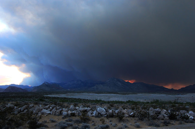
Update July 10, 2013. Containment dropped from 15% to 10 %. The fire has burned 25,000 acres. That equates to 40 sq miles. Roads into the area are still closed down to the public as firefighters continue to battle the wildfire. It is not expected that containment will be made until sometime next week. Depending on how the wind blows the smell of smoke, and falling ash, blankets Las Vegas at times. There are some spectacular sunsets, as the sun drops behind the billowing smoke, in late evening. A very visible indicator of the toll the fire is taking on the mountain.
 |
| Las Vegas Wildfire smoke - Looking West toward Mt Charleston July 10, 2013 |
Local news video http://www.ktnv.com/news/local/214829761.html?utm_source=Aptivada&utm_medium=email&utm_campaign=BreakingNewsKTNV
------------------------
As the 4th of July sun was setting on Las Vegas, an ominous smoke cloud was billowing up from Mt Charleston. The smell of smoke was detected in the air. From visual accounts we assume tomorrows high temperatures combined with increasing amounts of smoke might make for some difficult breathing for Las Vegas valley residents.
Below photo is ash on windshields of cars on the west side of Las Vegas (Durango & W Charleston area) the morning of July 5th 2013. The fire is in an area that is nearly a 1 hour drive away. Stay inside and don't breath this particulate matter.
  | ||
| Looking West at the Mt Charleston area. From the west side of Las Vegas 7/4/2013 8:00PM |
Photography by Rick Beach ©2013

No comments:
Post a Comment
Note: Only a member of this blog may post a comment.